Day 2 Villa Franca de Xira to Santarém


Today's ride was a hot slog on mainly gravel tracks through the flat river plain north east to Santarém. Walking this stretch must be soul destroying, a huge flat agricultural landscape very reminiscent of the Fens in the east of England.
First the metrics. The route was 54 kms with 140 metres of climb and 51 metres of descent. All the climb was at the end involving a very steep pull up to the town of Santarém. Moving time was just under 4 hours.

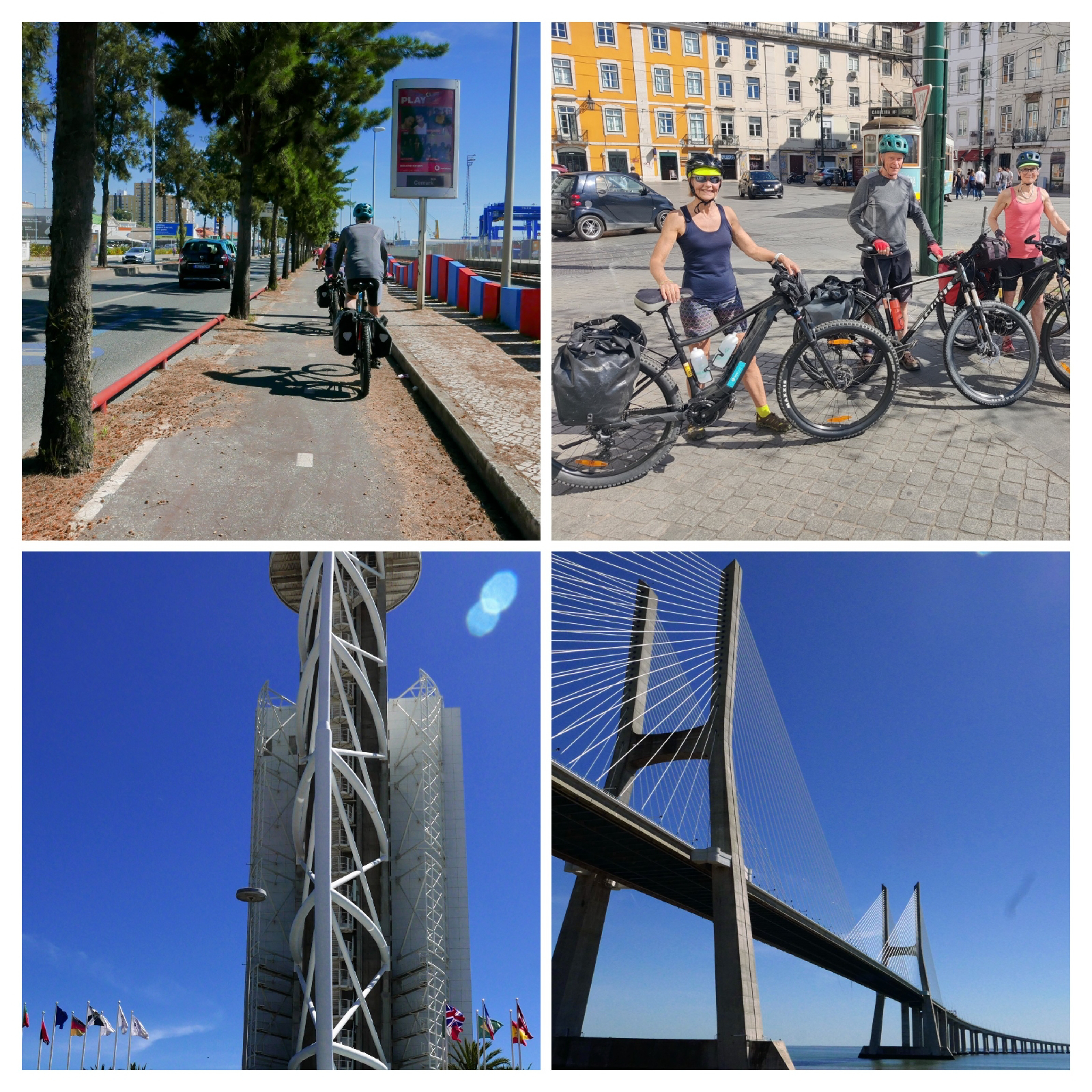
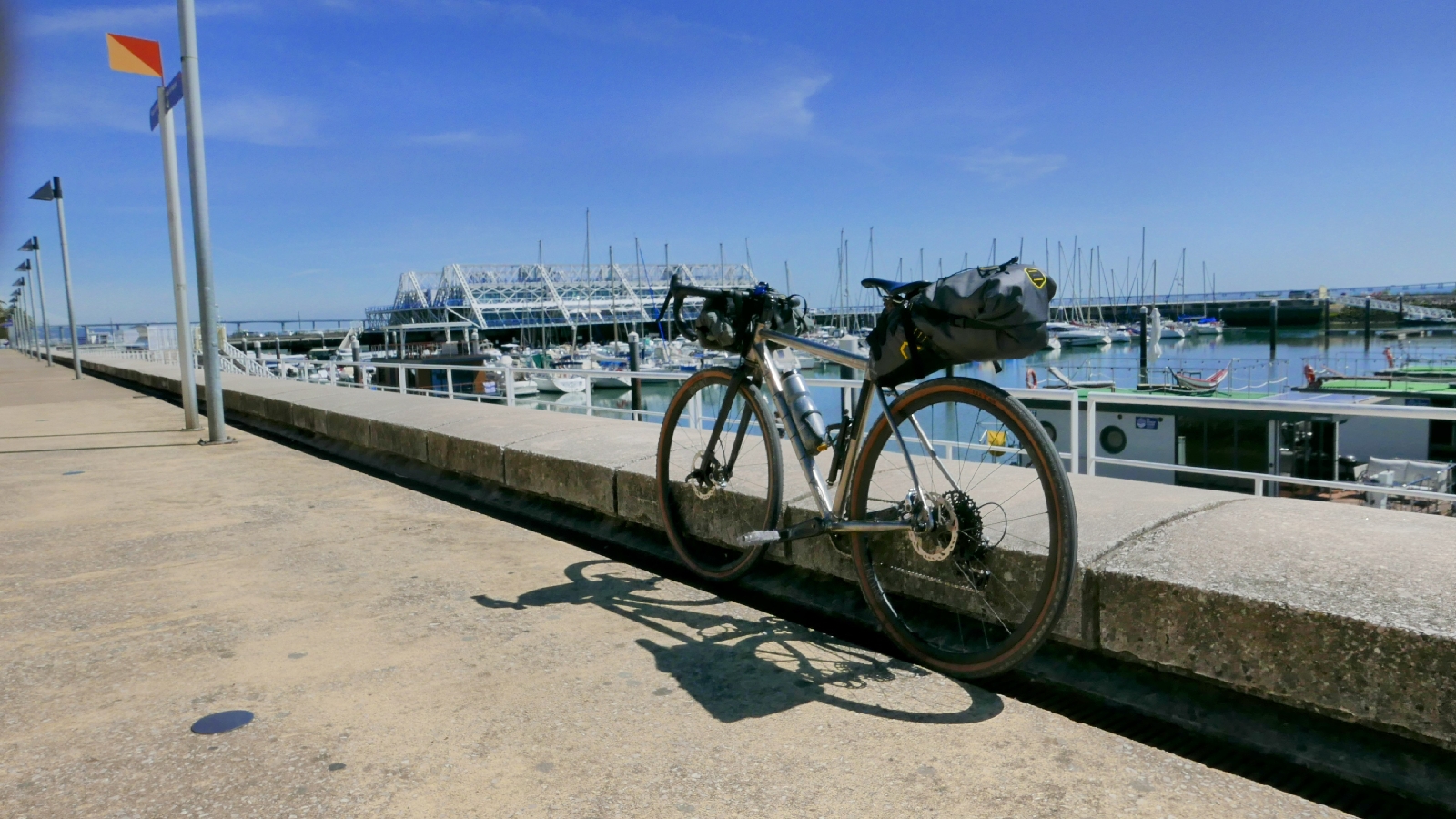
The big lesson for today was not taking the route too seriously. If we had followed the Camino we would have had to navigate three railway stations and after yesterday's experience with the lifts this was something we wanted to avoid. It did involve a bit more road cycling that might otherwise have been the case, including a 4 km stretch with bumper to bumper lorries, but after we had made it to Azambuja the railway line was at last behind us. After that we tended to be very close to the route (yards away) but not necessarily on it and to be honest even the pilgrims were involved in route rationalisation.
After Azambuja the landscape became seriously agricultural - super productive with nearly all the fields irrigated. We think the main crop was tomatoes, at a very early stage but fields and fields of them. In the middle of this ocean of agriculture was Vallada, a small village on the side of the River Tejo and clearly a pilgrim staging point. We stopped there for lunch and given the number of restaurants and cafes we chose well. It's a national holiday today and the locals were out on the beach while we enjoyed a salad and what we think were local shrimps.
Vallada was the perfect place to stop as it left just 20 kms (more fields of tomatoes) before Santarém, some shade and a beer.
We're still getting into the swing of things and spent the best part of an hour this morning waiting for a replacement charger for Robina's bike. By the time we had consumed our beers, showered and washed our clothes the "golden hour" was well underway. We still managed a tour of the Santarém ramparts at the end of the prominotory facing east with amazing views of the River Tejo both to the north and south. I suspect we have a bit more agriculture scenery to cross before finally escaping the river and heading into the mountains.


Day 1 Camino Portugués- Lisbon to Vila Franca de Xira


Day 1 was much better than I was anticipating. There was a lot of the urban sprawl you would expect around a capital city: the mix of new development and the dereliction associated with property waiting to be built; but there was also lots of quiet cycling through wide open countryside.

Day 1, starting at the bike hire shop and finishing at Vila Franca de Xira, involved 45 Kms of cycling with just 150m of climb and descent. According to Strava our average moving speed was just under 12km per hour, which makes sense give how much of the route was off-road. There was only one hill but it was a horrible one, just on the other side of an underpass south of Vialonga, and too steep to cycle with fully laden unpowered bikes. Christine and Robina sailed up it. The weather by way has been warm, verging on hot, we're experiencing at heat wave in April.

There was only one section of sustained mixed traffic cycling, a nasty busy road just to the east of Sobralinho, and apart from that the route sharing was with people including some pilgrims. There was a surprising amount of rough trail which would have been treacherous if things weren't so dry.

Some important lessons from the first day.

The decision, forced on me by majority rule, to go to Vila Franca de Xira rather than on to Santarém was the right one. Vila Franca de Xira has nothing to commend it but trying to get all the way to Santarém would have been a big mistake. If you're hiring bikes they take a bit of getting used to and there's always some fiddling about at the bike hire shop. All of this takes time so not being too ambitious on the first day was the right thing to do.
Secondly, ignore the Camino when you're cycling out of Lisbon. Lisbon is getting more cycle friendly but it's still an intimidating place to start a trip from. Finding your way out from the cathedral, where the Camino starts, involves lots of hills and a complex one-way system. The simpler way out is the harbour side cycle way which joins the Camino about 5km to the east of the town.

Thirdly it's important to remember that the Camino was designed for walkers not cyclists. It's OK for the route to take walkers the wrong way down a one way street but that's not always so good when you're on a bike. My route already missed the worst of the offending sections but ignoring the waymarks is sometimes necessary.
Highlights of today were the beautiful wild flowers, hedge high, all purples and yellows on the stretch between Bobadela and Vialonga. Also, for Christine and the other 2 carnivores, the unexpectedly good lunch in a simple village cafe: oxtail stew with proper home made chips and a bit of salad. €10 with fizzy water and coffee. I made do with a cheesy omelette and the same chips, but so far Portugal isn't great for vegetarians.
The biggest challenge of the day was getting the bikes through the station at Alverca do Ribatejo, to get from one side of the railway line to other. Getting massive electric MTBs in the lifts was tough to say the least.

Day 0 Camino Portuguese


Tomorrow we set off on a 28 day tour of Northern Portugal and a bit of Northwest Spain.  The plan is to cycle the Camino Portuguese Central up to Porto and then onto Santiago del Compestalla, turning round and then heading and back to Porto along the coastal variant of the Camino.  After that we'll return along the coast all the way back to Lisbon (taking the Eurovelo along a route I've done before so can vouch for).

I see "we" because as well as Christine, wife and partner on many previous adventures, Mike and Robina will also be making the trip.  The four of us cycled across Spain last year on the Camino el Cid and that was such a success that we've decided to attempt an even more ambitious trip in Portugal.


The pandemic already feels distant and it's sometimes hard to remember just how awful it was. but, amongst other things, I got out of the habit of blogging.  On this trip I'm going to revive it.  It's funny but having to say something about a journey made me think harder about what I was experiencing and the experience was better because of that: so I'm looking forward to this trip.


If cycling the Camino Portuguese "works", if it's likely to be attractive to cycling pilgrims, then I'll write the cycling route up in my 6th Cicerone travel guide. This will be a follow up on to my first Cicerone cycling guide which describes the Ruta Via de la Plata. 


Although the Camino Portuguese is not a cycling route like a Eurovelo, plenty of people have cycled it and indeed several holiday companies offer self guided itineraries. The route is particularly popular north of Porto as it's just far enough from Santiago del Compestalla to qualify for pilgrim accreditation. 


Exploring the route will involve two cyclists (Robina and Christine) on e-mountain bikes, one cyclist (Mike) on a mountain bike and one cyclist (me) on a gravel bike.  The intention is to stick with the Camino wherever possible but pre-identify the really nasty bits and find alternatives.  It's already apparent that a lot of the  route is "off-road" mostly on forest paths wide enough for a vehicle but some single track.  There are stretches where the surface is broken and as neither Robina or Christine are mountain biking experts it's these stretches we'll be trying to avoid.


So from tomorrow night you'll be getting the usual daily updates on progress.  If these updates suddenly stop, and previous entries are deleted, please assume the worst.  The trip wasn't a success!


Munich to Venice - When to Start

So the idea of walking from Munich to Venice across the Alps has sparked your interest; you've had a look at my blog about how tough it is, and it hasn't put you off; the next question might be "when can I do it?"

Sandwiched between the start and finish of a long winter, the Alpine walking season is short but there does seem to be some debate about how short.  Is it two months, July and August, or should you consider a third month, September. 

There are four things to think about:

Is it open, or put another way, are the passes clear of snow?

Are the huts (refugios in Italy) open?

What's the risk of bad weather?

How crowded will it be and how easy is it find accommodation?

Long-distance hikers heading south over the Alps need to cross a series of high-level passes.  Although the snow will have disappeared from the valleys, and local walkers will be out looking for early signs of spring, in all probability the paths across the passes will be blocked until into July (varies from season to season).  So although the huts start to open in June, the hiking season doesn’t really start until July with some risk of blocked passes early in the month.


Mountain walking starts mid-way through Day 3 and finishes on Day 26, so out of the 30 days hiking about 23 are spent in the Alps.  Chances are you will stop for three nights in the towns along the route (Hall, Alleghe and Belluno) staying for the rest of the time in mountain huts or small hotels on the passes. The earliest you can start is determined by the snow on the passes and the latest by the availability of accommodation in the mountains towards the end.  The last stage of high mountain walking, and perhaps the most remote, crosses the Civetta Dolomites between Alleghe and Belluno and as the huts in these mountains start to close in the last week of September you should aim to start this stage by the 22nd September.  So if you want to do the whole Traumpfad, all the way to Venice, you should have left Munich before the end of August. 


Snow the on the passes determines the earliest start date and the huts closing the latest, so what about determines the best time?

Weather is a consideration and although it  varies from season to season, July and August are the hottest. In August the heat brings a risk of thunderstorms, dangerous if you're exposed on the mountains.  Wet weather is always a possibility and if you're high this often means snow, even in August, and although the snow doesn’t last long staying an extra night in a hut can be the best option.  As the heat starts to drop off the risk of thunderstorms declines and September is usually the most settled month.


In the Dolomites in August things get busy, and huts need to be booked ahead, weeks ahead if you’re in a group.   It also means that anywhere near a chairlift, on the Sella Massif in particular, will be busy in the daytime.  The crowds all disappear before the lifts close and sharing a sunset and a beer in a full hut is a fun way to end the day.  Personally however I don’t like having to book ahead preferring scheduling flexibility. If the weather is good and I'm feeling good, than I don't want the day to end preferring to press on through the golden hour before the sun sets to turn up at a hut confident it will be only half full.  This means avoiding August.


July, August or September are all great months to make the trip across the Alps, adventure guaranteed but if you’re totally flexible with your calendar there is a lot to be said for getting to Munich in August, enjoying a couple of days warm-up heading up the side of the River Isar and then getting stuck into the mountains in September.


Update to the GR1 in Aragon - 2023


To be honest I feel mixed emotions when a walker using a guide points out a route change (thanks Amir).  On the one hand, a bit of my precious guide is out of date while, on the other, the route is still being worked on and taken seriously. This is exactly what's happened in Aragon in general and Huesca in particular.  As part of a 400,000 euro investment in the fabulous Sierra de Guara, the original routing for the GR1 has been diverted just east of Nazarre, southeast through Pardina Seral to Rodellar and then northeast and back up Letosa and Bagüeste before rejoining the original route back to Paules de Sarsa.


The change helps a lot.  Although it adds an extra stage, the stages are more manageable. Because of the lack of accommodation, Stage 5 in the guide is huge (12 hours), and although heading south to Rodellar adds the overall distance there is accommodation there (camping, in a refuge, or in a hotel).  So instead of Nocito to Paules de Sarsa, as described in the guide, the new recommendation is to go from Nocito to Rodellar (22.7km, 1010m up and 825m down taking an estimated 7h 35m), stop there, before heading to Paules de Sarsa (27.3km 1025m up and 1190m down taking an estimated 9hr 10m).


Abandoned houses in Used


Gaura in March

Follow the link to see the information panel for the route through the Sierra de Guara


Although I haven't walked the new Rodellar bits the report from Amir states that it is excellent although totally empty in March.  Rodellar is a major climbing and canyoning destination so it should get a bit busier from April onwards, as the season opens up, but don't expect crowds.  One slight regret is that the new route misses out Otin, the biggest abandoned town on the route, but there are plenty of other ones to explore.


As part of the upgrade, which was completed in 2022 and which apparently includes new signage, the available online information has improved since I walked the route 10 years ago. Better still the Aragon GR1 web presence has at least been matched by a similar effort in Catalonia.  This means that the GR1 through the pre-pyrenees, from Olite all the way to the coast is now up-to-date and accessible.


Both Catalonia and Aragon are promoting the GR1 as a coast-to-coast walk and while the guide describes how this can be done there is no evidence, as far as I can see, that their enthusiasm is matched by all the regions on the route. As before expect to see signage in the Castile y Leon, the Basque Country, and Navarre but there is still a small gap in Cantabria and a lack of enthusiasm in Galicia and the Asturias. 


My guide also heads from west to east whereas the websites go east to west. Finishing at the Mediterranean made sense to me back in 2012/13 but I know a lot of people prefer to follow the sun and head west.  I don't think it's a big deal either way although if you're using the guide as your only source of navigation (unwise) it's less useful if heading west.


Although GPX trails for the guide are available on the Cicerone website it makes sense to download them directly from the people who maintain them in Spain via the following links. At some point, the new route to Robellar will get included on the Openmap database and the IGN digital maps but this hasn't happened yet.


https://senderosturisticos.turismodearagon.com/senderos/gr1


https://senders.feec.cat/fem-muntanya/senders/sender/gr-1-sender-historic/


The GR1: Spain’s Sendero Histórico - still with a bed every night

Time flies.  It’s  10 years since I first walked the GR1, the Sendero Histórico, a 53-day walk across northern Spain.  Given everything that has happened since 2013, particularly in the last 3 years, some of the research I did for my first Cicerone guide, might need revisiting.  

The guide: The GR1: Spain’s Sendero Histórico, reflects my preferred style of walking and involves going from place to place and sleeping in a bed at the end of each day. This approach works particularly well in Spain because accommodation is cheap and relatively plentiful. It’s also great fun and although hit and miss, never less than interesting. Whether it’s a bar with rooms above or a luxury hotel in a converted castle, the memories associated with the places you stay can be as sustaining as the scenery you walk through.


If you prefer to sleep in a bed and enjoy someone else’s cooking, finding somewhere to stay can determine the length of each walking day.  Because the GR1 travels through remote countryside, often previously populated but now empty,  finding somewhere to stop for the night can be a challenge and occasionally involves some long days.  When I originally did the research I constructed a 53-day itinerary that allows a walker (defined as someone with a lot of spare time) to walk from one side of Spain to the other, stay in a bed each night, and only have to leave the trail three times.  Not having to mess about with taxis and buses; making a leisurely start and straight onto the trail; finishing the day by walking to your destination, and immediately drinking a well-deserved beer, are one of the many things that makes the GR1 special.


Over the last 8 years, since publication, lots of people (100s not 1000s), have used my guide to help them on their journey across northern Spain and a number have provided feedback.  When opening a GR1 email, I’m always nervous about updates on accommodation because, in certain places, a closure makes things difficult and a lot of closures would threaten the viability of the route for my style of walking.  The key thing to check, therefore, is whether the accommodation listed in the guide is still in business.


Recently, on a wet weekend in March, I worked through the guide to check what’s still there and establish whether you really need to take a tent with you to complete the GR1.  Good News! The GR1 still works for non-campers and despite Covid shutdown and some closures, you can still walk it and stay in a bed each night.  There are changes and, section by section, these are described below.


Some general things first.  There is an important distinction between a casa rural, usually private accommodation in a holiday home and an auberge, hostel or hotel. In Spain, particularly in a non-school holiday period, casa rural owners are often happy to rent a room just for a night, sometimes in an otherwise empty house.  Casa rurals are used in the guide when there isn’t an alternative, as managing access with a private owner is more painful.  Secondly some of the accommodation is seasonal and if you start your hike before April might be closed in places where there isn’t a choice.  Thirdly accommodation sometimes shuts on a Monday - as in many parts of Europe if people work on a Sunday they expect to have the next day off.  These places will sometimes provide a bed but no restaurant.


Section 1 - 6 days from Puerto to Tarna to Reinosa


Section 1, crossing the southern flank of the Cantabrian mountains and skirting the Picos de Europa, is one of the most dramatic parts of the whole walk. It’s an all-year-round destination for hikers (expect snow until March) and its attractions have kept all the accommodations open.  This includes the hotel in the tiny village of Salomon which provides the only accommodation at the end of the first day.  In addition, a new hotel has opened at Prioro, the Albergue de Prioro, so walkers no longer have to find a room in a casa rural.  


Section 2 - 7 days from Corconte to Berantevilla


Section 2 introduces the dramatic limestone escarpments and meseta which feature on much of the walk.  While there is more history, evidenced by castle ruins and lovely Romanesque churches, finding somewhere to stay is more challenging than in Section 1.  The main changes are two new hotels at the day 1 destination Pedrosa de Valdeporres,(the Hotel El Rincon and the Hotel Rural la Engaña, (which means not having to stay in the language school) -   and the closure of the Los Perrichicos and the opening of the Hotel El Amparo de Narcisa at Oteo.  Accommodation wise the final two days of the walk are just as difficult as in 2013 with off-route accommodation needed in Mirando de Ebro.


Section 3 - 6 days from Berantevilla to Olite


If I’m honest, this is my least favourite section.  The first 4 days to Los Arcos are excellent, more dramatic limestone ridges, but the last 2 days from Los Arcos to Olite which, despite interesting little towns, cross a boring agricultural landscape. Accommodation is also a little difficult.  The watermill, the only place at Peñacerrada, is still providing accommodation, but the Golf Hotel at Bernedo has closed, so the casa rural listed in the guide are the only places on the route.  If this doesn’t work there is plenty of accommodation a Laguardia about 7kms to the south.  At Santa Cruz de Campezo there is new hostel-style accommodation at the Aterpe Kanpex Hostel and all the other accommodation is as described in the guide.


Section 4 - 5 days Olite to Murillo de Gállego.


Long-distance walking inevitably involves swings and roundabouts.  If Section 3 had its shortcomings these are more than compensated for in Section 4 which somehow combines stunning landscapes with beautiful towns.  Accommodation in a casa rural still has to be found at the hilltop town of Ujué but a new hotel, the Beragu Hotel,  has opened at Gallipienzo Antiguo, another lovely town, almost abandoned but now coming back to life.  This means you can split the 35km walk otherwise needed to get from Ujué to Sos del Rey Catolico creating a 6 rather than a 5-day schedule.  The accommodation options have also improved at Biel, reached on day 4 (or 5 if you have split Day 2) with the new Casa Rural Las Lezas.  There is plenty of accommodation at Murillo de Gállego but it is seasonal and a lot of hikers suggest going a little further and staying at the atmospheric Refugio de Riglos named after the famous red limestone cliffs.


Section 5 - 9 days Murillo de Gállego to Graus


If Section 3 was my least favourite, then Section 5 definitely comes out on top.  Another remote section with fabulous scenery it adds the additional feature of a series of abandoned villages whose population seems to have cleared out overnight sometime in the 1960s. In planning a trip, the key thing to remember is that at least some of the accommodation is seasonal and somewhere to stay all the way through before April could be difficult.  Specific changes are: the closure of the Albergue A Gargale in Bolea in Bolea, the day 2 destination, so you have to stay at the restaurant, the Casa Rufino (or the pilgrim hostel);  the closure of the Hostal Migalon at Arguis on Day 3, so you now need to stay at the seasonal Hotel El Capricho, just down the road and off the route; and the closure of the UGT centre at Ligüerre de Cinca to overnight visitors with Casa A Chaminera (just down the road) the best alternative.

For an excellent and recent trip report on this section of the GR1 please follow the link to Joost's website

Section 6 - 9 days Graus to Gironella


Section 6 again combines remoteness with towering limestone cliffs, dry limestone plateaus and narrow limestone gorges.  Apart from one hotel at Sant Lorenc de Morunys (a town that has three other hotels) all the accommodation identified in the guide is still open for business.  This includes the lonely Masia Messanes reached on day 5 - it's lovely but I can’t understand how it survives, so please check.   Also the Masia el Pujol reached on Day 9 is closed on Mondays and Tuesdays.


Section 7 - 10 days Gironella to the Coast


Section 7 includes three different landscapes: the first is the tailend of limestone landscape of the previous three stages; the second, after Ripoli,  a landscape dominated by the pinnacles of long-extinct volcanoes; and, the third, after Banyoles, involving just two days of walking, the coastal plain.  The stage includes some really interesting historic towns with Besalu competing with Sos del Rey Catolico for the prize of the most stunning town on the route.  In terms of accommodation the Fonda Alpens reached on Day 2 has closed and if you can't get into a casa rurals in the village try the Casa de Portavela further along (although the website says a minimum of 2 nights) or organise a taxi for some of the trip to Ripoli.  At Sant Joan de les Abadesses a new hotel has opened, the Hotelet de St. Joan, providing a welcome alternative to the youth hostel.  At Orriels the very swanky hotel has closed so consider heading south for 3km to Hostal Can Maret (access could involve bushwalking!) or sticking to the trail for another 7km to Camallera and staying at the Pensio L’Avi Pep.


Many thanks to Daniel Harris who walked part of the GR1 in 2022 - the photographs in the blog are his


For a recent GR1 trip report please go to Joost's website


The Ruta Vía de la Plata gets a Guide


After a two-year Covid delay, the first English language cycling guide to the Ruta Vía de la Plata can be ordered from the Cicerone website. It's been a long time coming but I'm really excited - I think this is a special guide for what is a really special journey.

The journey starts in Seville and, from this splendid beginning, travels north through wonderful landscapes visiting a series of amazing towns and cities on a route that runs parallel with the Portuguese Spanish border.   Just north of Zamora and after crossing the famous Duero river, two options are offered. For cyclists seeking the full pilgrimage experience the first option heads west and ends up, via the Camino Sanabrés, in Santiago del Compostela. The second continues north and after visiting my favorite Spanish city, Leon, crosses the Cantabrian Mountains, stops off at Oviedo, and finishes at Gijon on the north coast. 

The Ruta has been in constant use since the Romans.  Its importance brought wealth to the towns and cities along its route, most of which are within a day's cycling of each other.    So after 4 or 5 hours cycling, a leisurely mid-afternoon Spanish lunch and a siesta, the evenings can be occupied with site seeing before rounding things off with people watching, beer and tapas. If you have any interest in Spanish History, the Game of Thrones, bagging world heritage sites, or just cycling and eating great food then this is the trip - it’s cycle touring at its very best.

Depending on whether you choose Gijon or Santiago del Compostela the schedule assumes 14 or 15 days cycling.  There are however lots of options and squeezing the trip a little, makes finishing it in a two week window more than feasible.

This is my fifth guide for Cicerone but my first cycling guide.  Cyclists come in all shapes and sizes and perhaps the most innovative thing I’ve done (pushed by the team at Cicerone) reflects this in the guide. What I’ve tried to do is provide information for the widest range of cyclists to follow a route that matches their own preferences.  The route itself makes this possible.  You can cycle from Seville to Gijon or Santiago del Compostela along well-graded empty roads perfect for road bikes.  This is because the Spanish national network (the N roads) has over the last 20 years been superseded by a new motorway and the N roads are, for the most part now empty.  At the same time, it is possible to go to the same destinations using the Camino routes which are largely off-road and suitable for cyclists who prefer a touring, gravel or mountain bike.   Much of the off-road cycling is amazing, providing intimate access to the wonderful and unique Spanish dehesa landscape, but some of it is boring or just plain difficult.  So for every day’s cycling, you can choose the off-road route or the road route or develop your own mix using the information provided to assess the attractiveness and difficulty of the off-road bits.

One thing I’m always asked about, whatever the route or mode of travel, is can you camp. Although I can usually provide a fairly general answer, it’s not based on a lot of knowledge and that’s because, unless I’m on a trip where someone else puts up the tent, I don’t do much camping. In Spain, especially as you’re cycling from town to town, the choice of accommodation is amazing and if you like staying in a place, castle or monastery or palace, this route provides lots of opportunities.

I’ve cycled all the road and off-road elements of the route to both destinations and if I have a personal preference it would be to include as much off-road as you have time for and to head for Gijon.  The destination choice is difficult because Santiago del Compostela is a lovely place but the final part of the journey is not as good as the Leon Oviedo combination and the ride along the Roman road over the Cantabrian Mountains is simply epic.

So at last, after a two year wait, the guide is now available.  It’s a great route and the guide I think will do it justice. 

Update - for more information on the route and guide why not listen to the Cicerone podcast