Nordalpine Weitwanderweg 01 - Test Run

The Nordalpine Weitwanderweg 01 looks like the toughest part of the walk and getting there early enough is a key consideration to the planning of the whole walk. To get an idea of what it's going to be like I'm doing a test run in July (with Christine, my wife). We are going to walk east for eight days starting at Bregenz in the middle of July.
The NordaplinWeitwanderweg 01 was opened in 1975 and is the first Austrian high trail through the eastern Alps. In the highest Alpine stretches it gets close to 3000 metres so the weather needs to be good for it to be safe. The Lechtal Alps, which are at the eastern end, the bit we will nearly complete in 6 days, is the toughest part of the walk. Christine and I have walked the Haute Route from Chamonix to Zermat and the Alta Via 1 in the Dolomites so I'm hoping we can cope with this.

The plan is to stay in huttes. Although we have had lunch in the Austrian huttes when we have walked there before we have never stayed in them. We have stayed in the equivalent in France and Italy and while the food was always good the accommodation can be interesting to say the least. In one French Hut it was a three layered bunk system with three people (mixed company) in each layer - very cosy but not much sleep. Funny thing is we have now sleep in some pretty extreme conditions, particularly in Nepal and Kazakhstan (in a tent on a glacier at 5,200 metres) but somehow you feel the discomfort more in Europe.
Getting there involves a flight to Zurich, from London, and a train to Bregenz. Bregenz is on the shore of Lake Constance (Bodensee in German) and the borders of Switzerland, Germany, Austria and Liechtenstien. It looks like a really nice place and we should have plenty of time to relax and have a nice meal before we disappear into the mountains the next day.
The daily walks are based on the schedule from the Austrian Alpine Club checked against the map. There is a guide book but it's in German. The Austrian Alpine Club website also has a hutte finder which describes the huttes and usually gives an estimate of the time needed to walk to the next hutte. Aligning the proposed schedule with the walking times is a bit of a challenge and I guess we'll need to flex the plan a bit when we actually get there.
Where to start is the first challenge. The first suggested stop is Freschenhaus which looks like a long way from Bregenz. Rather than waste time walking through Bregenz and then Dornbirn it looks like the best thing is to join the 01 at Dornbirn. On that basis the walk to Freschenhaus is about 8 hours long with a climb of 1,500 metres. The penultimate part of the walk involves climbing over Hoher Freschen at 2004 metres. A good first days walk!

Hoher Freschen
The next day involves a relatively flat and, on the map, not particularly long walk to the ski resort Damuls. Will be lots of places to stay so can work out where a bit nearer the time. Damuls is approximately 400 metres below Freschenhaus.

Day three involves a climb up to Biberacher Hutte. It doesn't look a very long walk, nor does it involve an enormous amount of climbing, but it does look exposed. In particular it involves a climb to 2013 metres over the Hochshere followed by what looks like a brilliant walk along the Hochshereweg. The Biberacher Hutte looks nice, has separate bedrooms as well as dormitaries. Guess what we'll ask for for!
The next day's walk involves what is supposed to be a 16 km walk to Goppinger Hutte. The walk starts with a drop of about 350 metres down the Furggeleweg and then up to a pass at the side of the Hochlichtspitze and then onto Goppinger Hutte. I guess if you get there early you then have the option of retracing your steps slightly and climbing the Hochlichtspitze which at 2600 metres is 350 metres higher than the hutte. Again the hutte looks nice with separate bedrooms. If you got there really early you could always try and get to the next hutte.

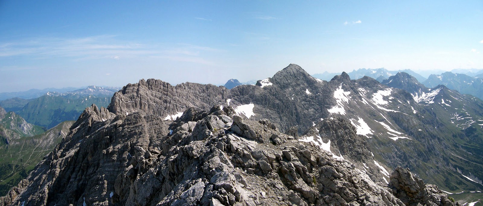
View from Hochlichtspitze
Day 5 is a short 4 hour walk to the Ravensburger Hutte which is supposed to be 4 hours from Goppinger.   You could try and do the next days walking as well as it's only  another six hours to Stuttgarter Hutte which is the next day's walk. It is however a bit confusing in E4 terms because after Ravensburger there is an 01 variant, with the route referenced in Austrian Alpine schedule taking you to Stuttgarter on the variant and the E4 on the main 01 route taking you the long way round. To make matters worse the Austrian Kompass maps don't align and the bit with the Ravensburger is on tiny bit of third map which I haven't bought yet! Sounds ominous and sounds like a good reason to do a short walk on Day 5

Day 7 looks like a lovely contour walk travelling 2500 kms above valley and looking down on St Anton.  The last overnight stop in a hutte is at Kaiserjochaus.
The last day involves a walk down to Flirsch, probably with lunch on the way at the Ansbacher Hutte.  The last night will be in a Hotel in Flirsch then a train on Sunday back to Zurich.

The Britain - Nepal Medical Trust

One of the objectives of the E4 Long Distance Walk is to raise money for charity. I discussed some of the issues in working out which charity in an earlier blog and, after some really helpful discussions with The Britain Nepal Medical Trust (BNMT) I have made progress. Current thinking is that, working with the BNMT over the next few months, we can develop a proposition which supports their objectives and is as interesting as possible to the people I’m trying to engage with on the walk.

So why Nepal and why the BNMT?

Nepal with 8 of world’s 10 highest mountains is an incredibly beautiful country and is a very special place for trekkers. My wife and I have been there twice (Annapurna and Everest) and we are going again in November to Kanchenjunga on our biggest trek so far.

You can argue that the history of modern trekking started in Nepal. In 1965 Colonel Jimmy Roberts, a former Gurkha Officer and Military Attaché at the British Embassy in Kathmandu, had the then revolutionary idea of providing trekkers with tents and Sherpas, to guide and cook, establishing a model which is still used. This opened up Nepal and the Himalaya to a wider community with many British companies, which now offer destinations worldwide, starting businesses in Nepal. Despite the growth of alternatives Nepalese treks feature high in any top ten list and the trek to Everest base camp is the trekker’s equivalent of a medieval pilgrimage. Sir Christian Bonington is one Patron of BNMT and Colonel James Stuart is another – maintaining a Gurkha link. A late founder patron of BNMT, Colonel Charles Wylie, was logistics officer to Lord Hunt’s successful ascent of Everest.

Nepal is also a very poor country and one of the least developed in the world. It suffered a 12 year civil war which ended in 2006 after 13,000 people had lost their lives. The monarchy has been replaced by a republic but peace is fragile. As well as the legacy of war the country has only embryonic governance and welfare structures, a particularly complex ethnic history and a very underdeveloped infrastructure. Many of its people though are lively entrepreneurs and show true resilience in adversity.

BNMT started in Nepal in 1966 when a team of British nurses and doctors approached the Nepalese government with an offer to help. It was established as a UK registered charity a year later. Initially concentrating on the control of tuberculosis (over 1 million BCG vaccinations provided by 1976) it has developed a broader based capacity building programme for improved health, transforming itself from a British to a Nepalese managed operation in the process.

Its current objectives sound familiar to those of us who have worked in UK local government, namely:

· To empower people at the community level by ensuring access to information and access and control over local resources and through increased assertiveness improve participation in decision making.
· To strengthen governmental and non-governmental health service providers at district, regional and national levels.
· To improve the livelihoods of disadvantaged people.

While the context is completely different to the UK there is a shared belief that empowering people locally secures good governance and good public services. The charity’s Board is UK based with British and Nepalese trustees.Company administration is from Tonbridge, Kent. BNMT is now a Nepalese managed operation with Nepalese Co-Directors and around 30 staff working on programmes “in country”. Compared to the UK, relatively small amounts of money go a long way in Nepal; the overheads to the charity are minimal and the impact of any funds raised can be very significant.

In discussions with Dr Ian Baker, a BNMT trustee, we have agreed that any sponsorship and other donations I receive for the E4 walk will raise money for the charity’s work. The projects in Nepal which are supported by funds I raise will be described on this blog and on the E4longdistancewalk.com website (once I’ve set it up), hopefully with some direct inputs from the staff in Nepal.

I packed my bag and in it I put..

How much you put in your bag makes a difference. If you're 12 stone, and you walk 9 hours a day at 3 miles an hour you consume 2993 extra calories a day. 9 hours is a lot of walking and three miles an hour is a sustained speed but this calculation assumes no climbing (using Naismith's rule you add half and hour for every 1,000 feet climbing). If you're 14 stone, you consume an extra 500 calories. Now I'm not sure if carrying a bag weighing 2 stone makes 12 stone person the equivalent of a 14 stone person (without the bag) but there must be a rough equivalence. An extra 500 calories a day is a lot, 90,000 calories over the length of the whole walk, or 30 days extra food consumption!

A helpful list for loading your bag is provided on the Confraternity of St James website (for walkers planning for the St James Way walk).

Not sure about the starting premise which says you need a 60 litre bag if your a man and a 35-45 litre bag if you're a woman. I guess it's assuming that you can carry more and that some of the items of clothing are bigger. Anyway 60 litres is a much bigger that any bag I've carried so I must be doing something wrong (or right).

I don't think you need much in the way of clothes. The key thing I guess is to be able to wash them and to make sure sure that everything is made of the latest quick/drip dry synthetic materials. Three tea shirts, shorts/trousers, fleece, waterproofs,hat, something to put on your feet in the evening and socks seems enough to me.

Wasn't much taken by the idea that you can buy specialist clothes with silver threads that can absorb oder for up to three weeks. Is that the same underwear for three weeks?

The suggestion that you rub your boots with wild fennel or mint whenever you get a chance seems like a good idea, particularly if you've been wearing your underwear for three weeks.

Anyway the top tens question I need to answer before packing my bag:

1. How long do socks last, how many miles?
2. How many pairs of socks should I take given that they take forever to dry?
3. How long do boots last?
4. Will I need to wear some boots in before I start or do your feet change shape after so many miles walking?
5. Will my clothes last 180 days of walking, or will I need to be sent supplies?
6. Given that I look like an idiot in a hat, what sort of hat should I get?
7. What is the very best stuff for keeping mosquitoes at bay? They will already know I'm coming.
8. Should I go modern and get one of those integrated watering systems (intravenous?)?
9. Will I need the same clothes in Austria as I need in Spain?
10.Should I take my ipod?

Eurorando 2011


Brilliant. Eurorando is the five yearly celebration of the E long distance walking network and the next one is in 2011 coinciding perfectly with the planned amithefirst "conquest" of the E4. If that bit of good fortune wasn't enough the association organising the event is Spanish (the FEDME) with the walking club in Andalusia taking the lead. Tarifa, the starting point for the E4 walk is in Andalusia. The only slight problem is that I'm proposing to walk from west to east so I should be in Budapest when everyone else is celebrating in Granada. Small detail to be ironed out at a later point.

Plans for the Eurorando 2011 are well advanced - its a significant event for tourism in Andulasia and if I understand all the documents correctly there is a budget of some 1.6 million euros. There is even a video which looks great (but of course is in Spanish).

Apart from creating a bigger interest in the concept of the long distance walks I'm not quite sure yet what this means for the amithefirst project. What I need is a really good Spanish speaker to help me engage with the project team in Andulasia to see if they are interested in promoting my attempt.

Which Charity?

After completing the walk the second objective for the amithefirst project is to raise money for charity. So which charity?

I get lots of different things from walking. One of the particular pleasures, especially on the big iconic walks like the Haute Route, or Everest Base Camp, is the sense of international solidarity you get from sharing something with people from different countries. So it was a special Christmas Eve spent drinking with a group of Mexicans, Spanish, Indians and Nepalese in a freezing tea house at Poon Hill on the Annapurna Circuit. The memory of the tiny Nepalese porters giggling uncontrollably as the much larger, in your face, female trekkers from Spain sang louder and louder as they drank more and more Indian whisky is both really nice and in a way inspirational.

The E network of trails is, in itself, a sort of international solidarity manifestation. The European Ramblers Association, which looks after the network, exists to promote trans border access for walkers and to support "activities which serve to strengthen greater understanding between the peoples and nations of Europe".

So a charity which promotes international solidarity seems to make sense.

It would also be nice to support something that was real and generated a tangible result.

In both Nepal and Ethiopia we were lucky to get invited into local schools. In Ethiopia we were invited into schools in Lalibela (famous for its churches carved out of rock) and later on the trail itself in the village of Chiro Leba (the day before climbing Ras Dashen). Both schools were joyous places with children seeing education as way to a future. In Lalibela we were struck by the organisation. A large school, children started at different ages and were taught by a combination of teachers and other children who had learnt more. To add to the organisational complexity the school ran a two shift system with a 1,000 or so children attending in the morning and another 1,000 going there in the afternoon (different children - same teachers). In Chiro Leba the school was much smaller, uneven earthern floors, with walls incapable of keeping livestock out when the children weren't not there (the evidence was on the floor). Throughout our time in Ethopia children came up to you not for money but for pens. The empty biro refills (the bit in the middle not the pen) on the floor of the school in Chiro Leba showed us why.

So a charity which supported international solidarity and which did something tangible, which made a difference to say a school in Ethopia, would be nice.

What I'm looking for now are some ideas.

How many days will it take to walk the E4?

Probably turning into some sort of mapping/internet nerd but I have found researching the walk really interesting. The key thing is that there is no one source of information that takes you from one end of the walk to the other. At the European level the walk is described on the European Ramblers Association website, and even on Wikipedia, but not at the level of detail you need to determine the daily length of each walk. Wikipedia (when it does do detail)is sometimes wrong. Plotting the route, from end to end, has therefore involved piecing it together from a whole series of sources (translating the sites into English using the Google translate tool)and then estimating what the daily walks will involve.

I have plotted the route in Google Earth. Google Earth is incredibly powerful and I'm still learning how to use it. I now have a file, which plots my version of the walk, which I can "play" in Google Earth. This means I can fly virtually, place to place, from one end of the walk to the other. Nerd or what!

What I haven't worked out is how to publish my file, i.e. share it on the internet. I'm sure this is possible so hopefully I can do it soon.

Some of sources of information actually provide walking times and I have used these to plan the days. Where this is not available I've used Google Earth. Previous planning experience suggests that I can overstate my daily walking capacity (12 hour walking days in the Dolomites bear witness) so the current plan will definitely need some more work.

What the plan is telling me is that I need to walk for 172 days (I have walked 16 before!). If I walk six days, and have every 7th day of, this makes for a total elapsed time rounded up to 200 days.

If I have got this right it could work. What it means is that I could start at Tarifa at the beginning of March and spend the spring crossing the Sierra Nevadas and eastern Spain. By mid-May I will be in France and the Cevennes, going up the Rhone Valley to Grenoble in June/July. The Swiss part of the walk looks really nice and easy and I should be able to get to the tough Austrian part mid-way through August. The Der nordalpine Weitwanderweg 01 looks brilliant but is the highest and most exposed part of the walk, involves 40 days walking, so I need to start this as early in August as possible.

Bridges burnt and initial plans

Well I have now burnt the bridge of employment (technically just on fire as I will still be working until August). This means that the biggest obstactle to the E4 walk, time, has now been removed and that, theoretically, I can do it.

Have got a lot more information on the walk, have plotted it on Google Earth (haven't worked how to publish it) and the detail of it makes it even more interesting. I should be able to work out a start date soon and when I expect to have arrived at key points along the way.

Based conversations so far, some objectives for the walk have started to emerge, namely:

• complete the walk - get from Tarifa to Budapest (although the option of the eastern Hungarian border has been suggested)
• build up a network of people interested in the route (and beyond Hungary) and want to participate at some level
• promote cultural activities associated with the route
• link communities
• build a resource which can be used after the walk has been finished (a web-site, a book)
• raising money for charity